– Job Announcement – Business Development & Compliance Manager
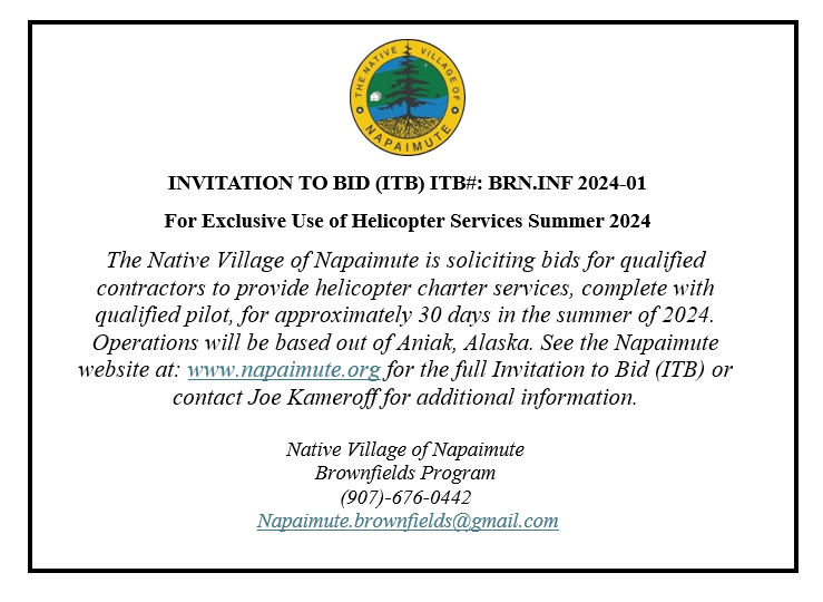
– Invitation to Bid –
Link
Job Announcement – Maintenance Director
Public Notice: Request for Extension for ICDBG-ARP Grant Award Number: 22-RP-02-10670
To Whom It May Concern:
This is notice that the Native Village of Napaimute is applying for an extension for ICDBG-ARP Grant Award Number: 22-RP-02-10670.
The original grant period ends 12/31/23.
Low water in the Kuskokwim River in October prevented barge delivery of the completed starter home to its final destination at Napaimute. An extension to this grant is necessary to allow for barge delivery early in the summer of 2024.
If you have questions or concerns, please contact the Napaimute Traditional Council Office at (907) 545-2877 or by email: napaimute@gci.net
Thank you.
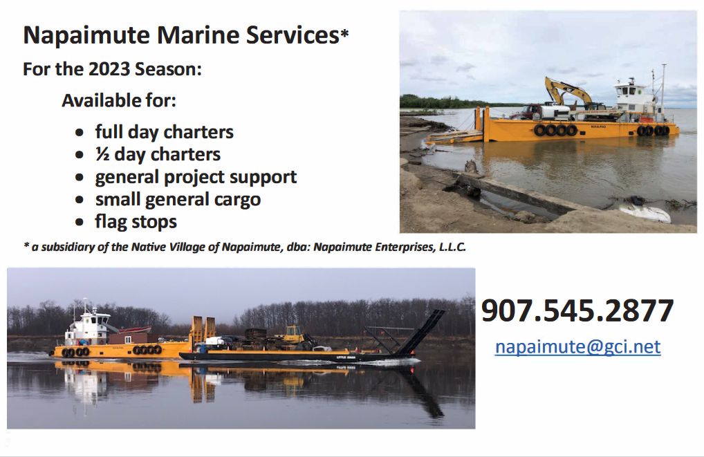
2023 NVN Marine Services
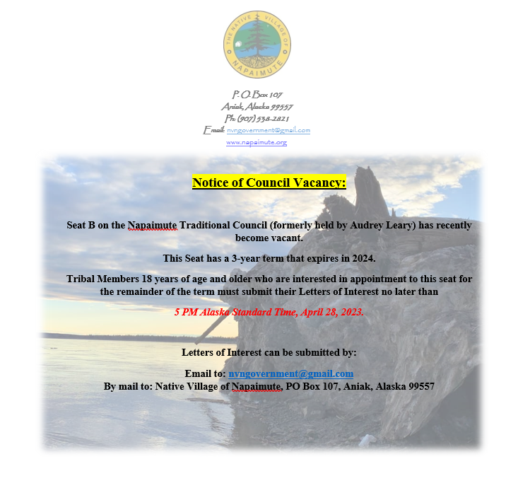
Notice of Council Vacancy
Donlin Mine Information
I have consolidated all Napaimute’s post related to the Donlin Mine project under this new tab “Donlin Mine”. This is so that folks can more easily locate the post we have put up over the years.
The following link to the Department of Natural Resources contains links to all of the analysis, decision memos, and permits that have been issued to date.
http://dnr.alaska.gov/mlw/notice/donlin/
The table below summarizes the Donlin Mine permitting status. The public comment period for the Pipeline Right of Way is open until November 9, 2020. The notice is attached below.

Public Notice
DOG-State Pipeline Coordinator_s Sectio..
Position Opening: Tribal Accountant
Click here to view position opening announcement: